


CHOCTA-Voting District, Walton County, Florida
About
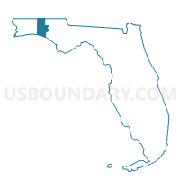
Outline

Summary
| Unique Area Identifier | 560165 |
| Name | CHOCTA-Voting District |
| County | Walton County |
| State | Florida |
| Area (square miles) | 44.73 |
| Land Area (square miles) | 32.11 |
| Water Area (square miles) | 12.62 |
| % of Land Area | 71.79 |
| % of Water Area | 28.21 |
| Latitude of the Internal Point | 30.49876520 |
| Longtitude of the Internal Point | -86.34044600 |
Maps


Graphs
Select a template below for downloading or customizing gragh for CHOCTA-Voting District, Walton County, Florida


Neighbors
Neighoring Voting District (by Name) Neighboring Voting District on the Map
- 23A-Voting District (Eglin AFB), Okaloosa County, FL
- 26A-Voting District (North Bay), Okaloosa County, FL
- 49A-Voting District (Regatta Bay), Okaloosa County, FL
- EGLIN-Voting District, Walton County, FL
- MIRAMA-Voting District, Walton County, FL
- PORTLA-Voting District, Walton County, FL
- SANTA-Voting District, Walton County, FL
Top 10 Neighboring County Subdivision (by Population) Neighboring County Subdivision on the Map
- Fort Walton Beach CCD, Okaloosa County, FL (87,627)
- Niceville-Valparaiso CCD, Okaloosa County, FL (34,279)
- Walton Beaches CCD, Walton County, FL (18,452)
- De Funiak Springs CCD, Walton County, FL (14,977)
- Freeport CCD, Walton County, FL (9,405)
- Eglin AFB CCD, Okaloosa County, FL (4,949)
Top 10 Neighboring Unified School District (by Population) Neighboring Unified School District on the Map
Top 10 Neighboring State Legislative District Lower Chamber (by Population) Neighboring State Legislative District Lower Chamber on the Map
- State House District 7, FL (169,309)
- State House District 5, FL (154,014)
- State House District 4, FL (144,198)
Top 10 Neighboring State Legislative District Upper Chamber (by Population) Neighboring State Legislative District Upper Chamber on the Map
Top 10 Neighboring 111th Congressional District (by Population) Neighboring 111th Congressional District on the Map
Top 10 Neighboring Census Tract (by Population) Neighboring Census Tract on the Map
- Census Tract 9506.03, Walton County, FL (7,367)
- Census Tract 210.01, Okaloosa County, FL (5,598)
- Census Tract 9503.02, Walton County, FL (5,422)
- Census Tract 208, Okaloosa County, FL (5,114)
- Census Tract 9505.02, Walton County, FL (3,725)
- Census Tract 9902, Okaloosa County, FL (0)